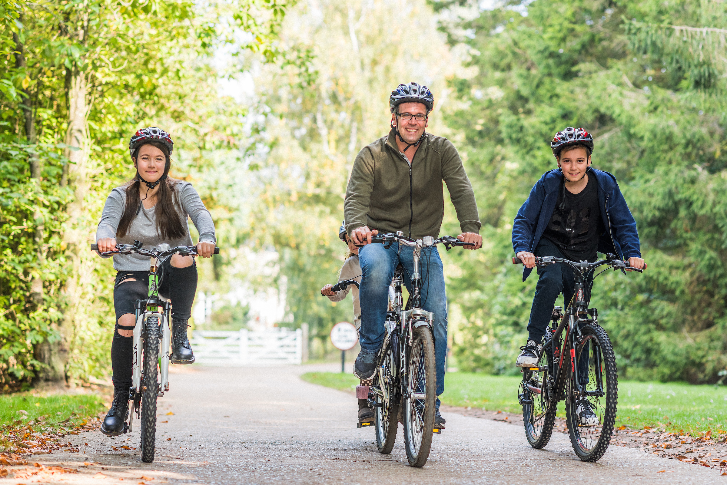
CYCLE RIDE & PICNIC


This is a magnificent day out for more experienced cyclists designed to help you discover as much of the Broads National Park as possible in a single day. It is not suitable for young families or those unprepared for a day in the saddle, but offers a unique and rewarding way to explore the area.
Don’t worry if you haven’t brought your own bikes, as there are a number of cycle hire centres located in and around the Norfolk Broads, supported by the Broads Authority. A leaflet is available from Visitor Information Centres providing details of their locations and contact telephone numbers. We have chosen one such centre, at Clippesby Hall, near Acle, and designed a 35 mile route around the Norfolk Broads, but other centres will be happy to provide suggestions for days out in their local areas.
Our recommended itinerary is as follows:
• Having packed your picnic lunch, start from Clippesby Hall reception and coffee shop, which is located off the B1152 between Acle and Potter Heigham
• Take a bike, with cycle hire available if required, and pedal your way along the quiet lanes first stopping at the old stone bridge crossing the River Thurne at Potter Heigham

• Cross the main A149 carefully at the safe crossing point and continue through the old village of Potter Heigham to Hickling
• Head along the route of the Weavers Way long distance path, past Sutton Mill (now in private ownership), the tallest windmill in England, and back across the A149 to Sutton Staithe and a view of what remains of Sutton Broad. Refreshments are available here at the Sutton Staithe Hotel
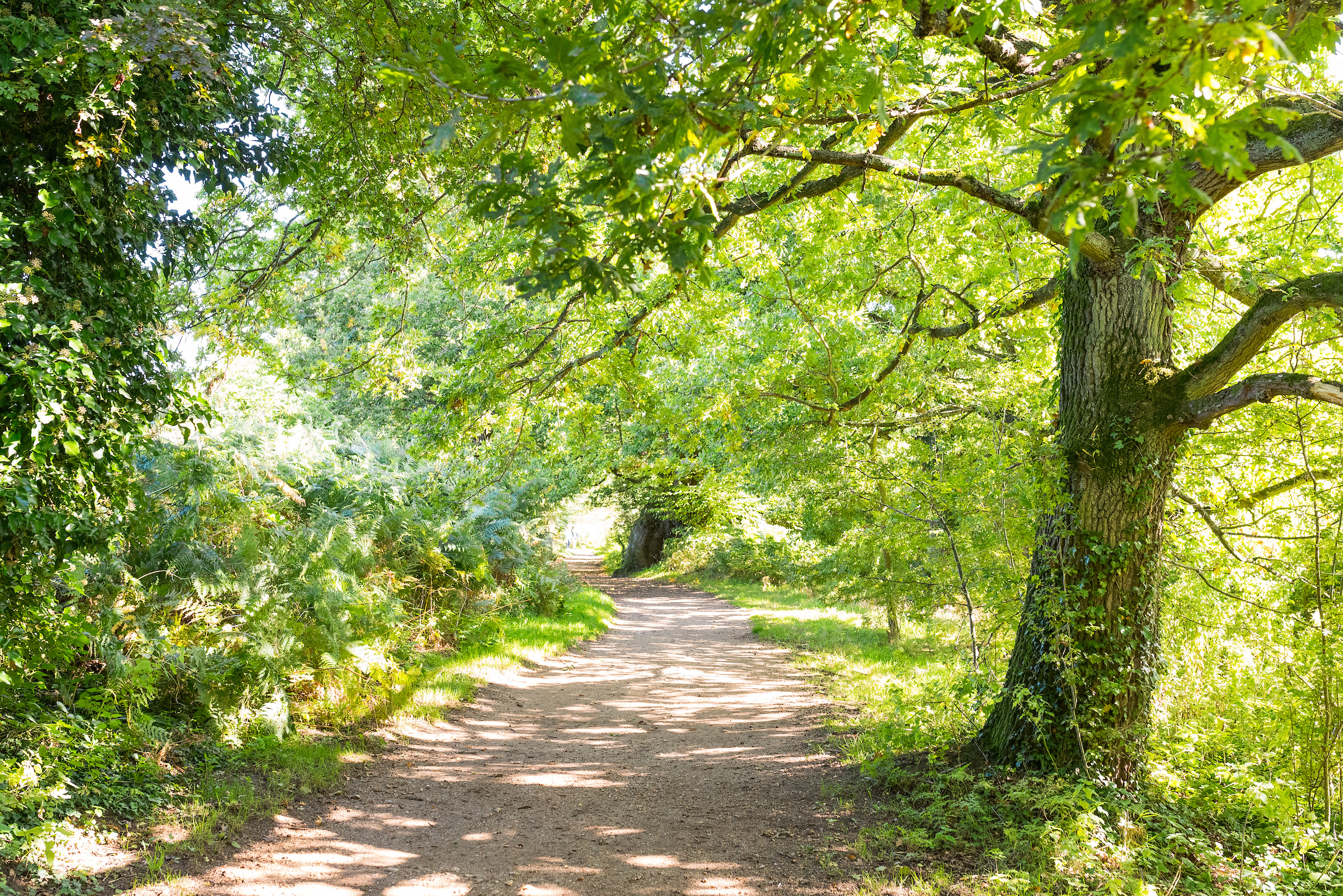
• Re-cross the main A149 and find your way into Stalham, all the way along the main street, and just before this road re-joins the A149, bear right through a gate onto the Weavers Way. This is a traffic-free path along the route of the old railway line and can be used by walkers, cyclists and horse riders
• Continue for around 3 miles along this track (shown in green), which can be a little muddy and uneven, carefully crossing several quiet lanes until the entrance to a property on the left coincides with a footpath to Honing Lock, the remains of a lock on the only canal in the Norfolk Broads and the site of the now disappeared Dilham Broad, and a great picnic spot if you have one with you
• Returning to the track, after a quarter of a mile, just under the road bridge, leave the track to the right, join the road and turn right, over the bridge and follow this lane into the village of Dilham. The Cross Keys pub is on the left, which is a good place for further refreshment if required
• Through Dilham, the route joins the main A149 for a short distance. Turn left onto the main road, continue past the Crown Inn and then take the first right turn. Just past the church, turn left, continue for just over half a mile and then cross over the main A1151, signposted towards Barton Turf and Neatishead
• Continue along this lane into the village of Neatishead, turning left opposite the White Horse pub. Along this lane you will pass the moorings of the Ra, Britain’s first solar powered passenger boat, but continuing past this will bring you to the start of a boardwalk. There is cycle parking at the second entrance on your left, and a short walk through the swampy woodland will bring you right to the edge of Barton Broad, with views over the Broad itself and a great picnic spot
• Back in the saddle, turn left out of the car park along the lane, turn right at the crossroads and follow this lane to another crossroads, turning left. After around half a mile, and not signposted from the road, there is a track on the left just in front of a property, and this leads down to Alderfen Broad
• This is one of the hidden places of the Broads National Park, visited by very few people. A Nature Reserve acquired by Norfolk Wildlife Trust in the 1930s, there is a sense of peace and tranquillity here that is difficult to match elsewhere
• We recommend you take a few minutes to wander to the bird viewing hide and absorb the atmosphere before continuing with the remainder of the ride
• Back to the road, turn left and then right, past the RAF Radar Museum, and then left at the junction before crossing the main A1062 and proceeding into Horning village
• The village is ideal for a leisurely stroll, with the path by the water’s edge, the ancient buildings around the green, together with several interesting shops and tearooms. There is an emphasis on local produce in the village, with a visit to The Galley a must. A traditional deli, it sells a wide range of local produce including cheeses, preserves, beers, ciders and much more, and also houses a small art gallery and tearoom
• When you are ready, continue through the village past the remaining shops and boatyards and after a short climb, turn right just in front of a school, to Horning church. A path at the back of the churchyard leads down to the river, and if you have time, this is worth a stop
• Back on the road, turn right at the crossroads and then follow the road around to the left, before carefully turning right onto the main A1062 and continuing for around a mile and a half, over Ludham Bridge
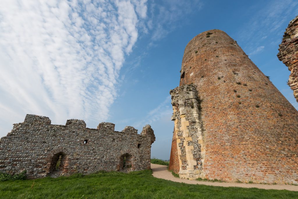
• Turn right just past the Dog Inn, which is a suitable place for further refreshment, along a quiet lane. Along on the right you can catch a glimpse of the remains of St. Benet’s Abbey, founded in 1020 and never dissolved by King Henry VIII, and if you have time, you can follow the farm track signposted on the right, down to the ruins, adding approximately 2 miles to your trip
• Continuing along the lane and bearing left at the end will bring you into the village of Ludham, possibly stopping for afternoon tea at Alfresco Tearooms opposite the village church, a friendly, typically English tearoom, with a secluded courtyard area which is perfect on sunny summer days
• As you return from Ludham along the quiet lane to the north of the main road and then back over the river at Potter Heigham, don’t miss the sight of the old RAF airfield on the left. Spitfire squadrons flew from here in the Second World War, including ace pilot Johnny Johnson, and the control tower is still visible across the fields to the north
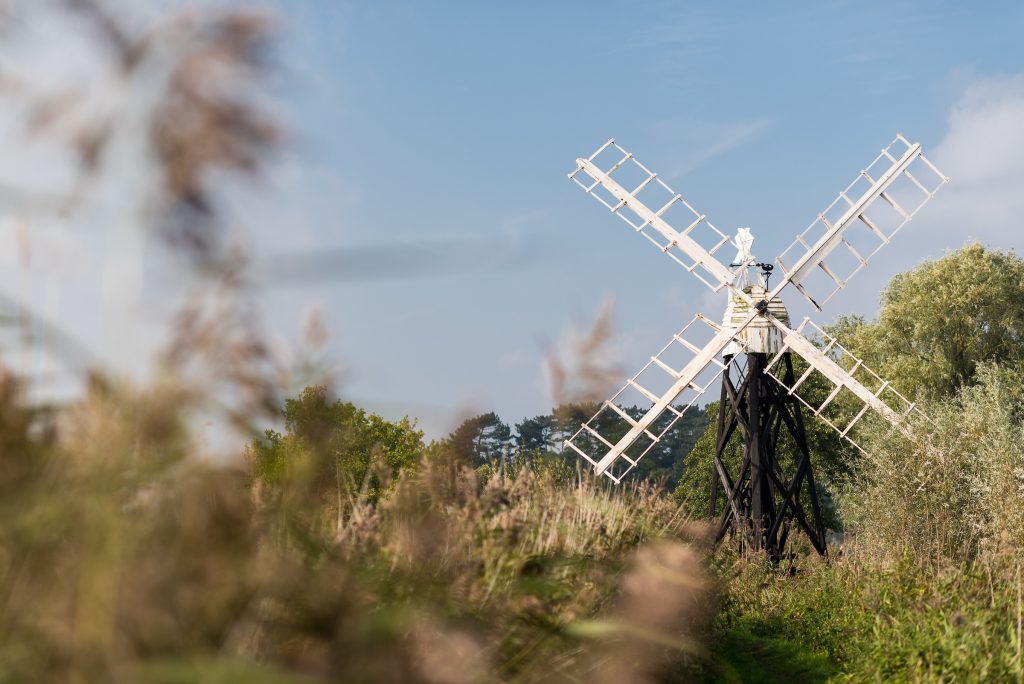
• If you still have time (and energy) on the way back to Clippesby from Potter Heigham you could take a right turn and follow the quiet country lanes down to the river at Thurne, taking your bikes to the windpump at the end of the dyke
• The windpump has recently been restored and is now back in working order. This is a well photographed spot and a fitting conclusion for your discovery of the Norfolk Broads in a day
• The village has a pub and a gift shop, together with a children’s playing field and a picturesque thatched church standing a little way out of the village on the hill overlooking the river


BARN OWL
Part of Norfolk’s folklore, the sight of one silently patrolling a Broads field at sunset is unforgettable...BARN OWL
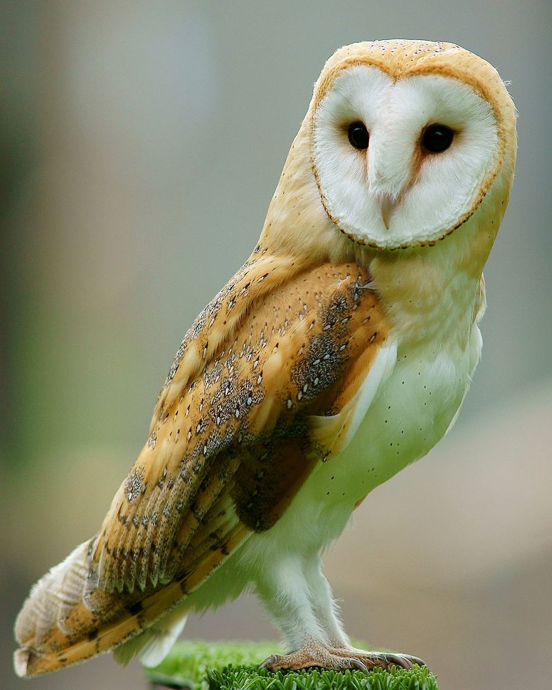 Unlike the tawny owl, they do not hoot, making clicking sounds or blood-curdling screams instead.
MORE FROM OUR COLLECTION
Broads in a Day – Cycle Ride
CYCLE RIDE & PICNIC This is a magnificent [...]
Barton and Alderfen Broads
WALK Exploring the Broads National Park on foot can [...]
Martham to Horsey – Canoe
CANOE TRIP This is one of our favourite days out, [...]